Examples
These examples show some use cases of osm2pgsql and highlight some features.

Raster Tiles
This is the "classical" job of osm2pgsql: Import OSM data into a database to create raster tiles from.
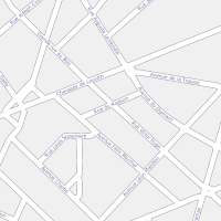
Vector Tiles
Osm2pgsql imports OSM data using a very flexible configuration making it easy to generate any kind of vector tiles.
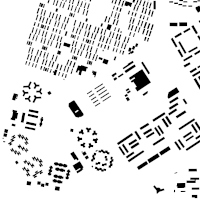
Building Map
Need only a few feature types? Import only what you need for a quick map.
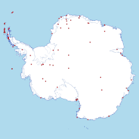
Antarctica Map
Osm2pgsql can use many different projections to fit the area covered and your use case.
Geospatial Analysis
An osm2pgsql database is well-suited for geospatial analysis using the power of the PostGIS database extension.

Creating a POI map
Use osm2pgsql to create a points-of-interest map.

3d Buildings
Use height information on OSM buildings to create a simple 3d map.

Exporting OSM Data
Osm2pgsql and a database can be used as a step in exporting OSM data into many different GIS formats.

Raw Data Publication
The raw OSM data can be published via a web API using pg_featureserv