Example: Creating a POI map
You need at least osm2pgsql version 1.7.0 for this example.
Points of Interest (POI) such as restaurants, shops, etc. can be mapped in OSM
in two different ways. Either as nodes, i. e. as a single point, or as closed
ways, usually with an additional building tag. When you want to show POIs on
the map you often don’t need to render the buildings they are in, you just need
a single location where to put an icon.
With osm2pgsql this is easily done. Here is the Lua configuration:
local pois = osm2pgsql.define_table({
    name = 'pois',
    ids = { type = 'any', type_column = 'osm_type', id_column = 'osm_id' },
    columns = {
        { column = 'name' },
        { column = 'class', not_null = true },
        { column = 'subclass' },
        { column = 'geom', type = 'point', not_null = true },
}})

function process_poi(object, geom)
    local a = {
        name = object.tags.name,
        geom = geom
    }

    if object.tags.amenity then
        a.class = 'amenity'
        a.subclass = object.tags.amenity
    elseif object.tags.shop then
        a.class = 'shop'
        a.subclass = object.tags.shop
    else
        return
    end

    pois:insert(a)
end

function osm2pgsql.process_node(object)
    process_poi(object, object:as_point())
end

function osm2pgsql.process_way(object)
    if object.is_closed and object.tags.building then
        process_poi(object, object:as_polygon():centroid())
    end
end
We define a single table called pois with a point geometry column, a column
for the name of the POI and class and subclass columns for the type. Most
POIs will either have an amenity or a shop tag, the tag key will be written
to the class column of the table, the tag value to the subclass column.
You can extend this with other POI types or filter the data as needed.
For nodes we get the point geometry directly. For ways we get the polygon
geometry and calculate the centroid (center point) from it. If something
fails, because the way is not a valid polygon, the geometry will be null
and nothing is written to the database because of the NOT NULL declaration
of the geometry column.
To load the data, create a PostGIS database pois as usual and then run
osm2pgsql with some OSM data extract or the planet file:
osm2pgsql -d pois -O flex -S pois.lua input.osm.pbf
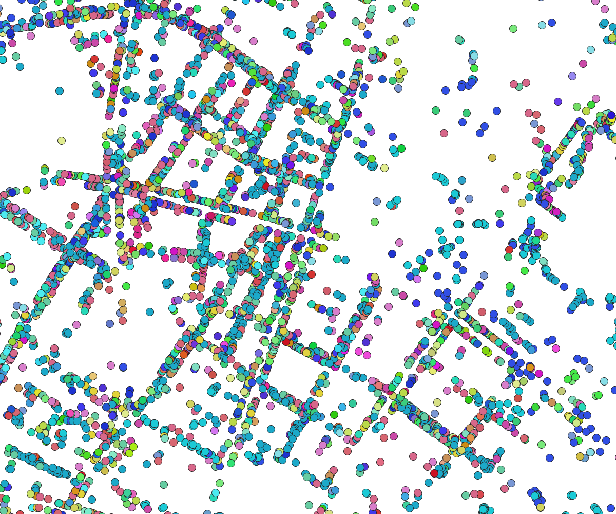
For the image on the right we used an extract of the city of Berlin using different colored dots for the different types of POIs. In a real map you’ll probably use icons of course.